How to get to Ciudad Perdida (Lost City)
In order to reach Ciudad Perdida is necessary to take the road Santa Marta-Riohacha and deviate in Guacha Puerta Nuevo, kilometer 52 towards the town of El Mamey. From that point two or three days walking a horseshoe road and a pedestrian path are necessary for reaching the Archaeological Park. You can choose between three paths, each one harder than the other to get to Teyuna.
FIRST WAY
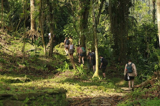
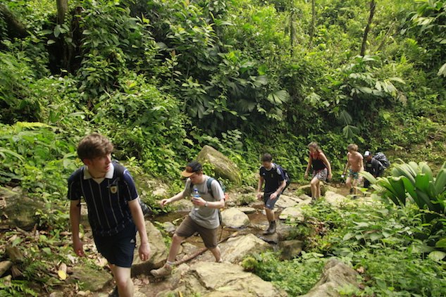
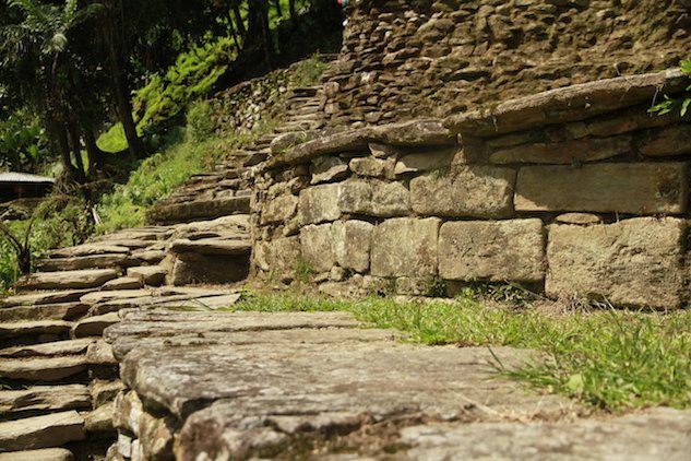
This path crosses the margins of the river Guachaca and Mamey. At the beginning of the hike you will cross the ruins of Mutanyi and Koskúnguena, old villages of the Koguis, and they will be your first contact with the mysticism of the pre-Hispanic cultures. At the beginning of the ascent there is a large stone made staircase that has 1200 steps and works as a threshold to the main ruins. The route that arrives there crosses several times the Buritaca river, so you must be attentive, as there is danger of rapid growth of the river. This route is the shortest and is the one that offers less landscapes to enjoy. The road has constant traffic and many of the visitors are foreigners, who usually travel in groups of between three and ten people.
SECOND WAY
This tour is more difficult, made for adventurers.
The first stretch is in the wild and leads to Minca, and from there to Tagua, an area covered of humid forests and an irregular relief that cause overuse in the legs. This journey leads to Filo Cartagena, where a shelter has been built for the walkers to recharge their energies in order to continue the tour.
The second day starts with a walk through crystalline rivers and at the end of the day you can rest on the ruins of a Tairona settlement in which archaeological excavations have been done and have provided material for further investigations of this culture. On the third day the walk gets harder, the terrain becomes very unstable and the walking pace becomes slower. You have to cross the rivers Buritaca and Guachaca to be able to reach Ciudad Perdida. Tourists who have made this pilgrimage coincide in that, despite the tiredness of the long journey that at times seems endless, the place does not lose its magic and the forces to continue come from the same mountain and of the desire to know what lies beyond.
THIRD WAY
This option is the riskiest, because it is necessary to have previous knowledge of mountain climbing. It offers the ascent to the snowy peaks, the lagoons and the ruins of Arhuacos settlements. The entrance is in the South area of the Sierra, in Cesar department and the route takes more days.
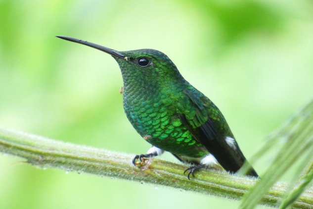
In all three routes, besides a wide richness of flora and fauna, you will appreciate a complex system of constructions, paved roads, stairs and walls intercommunicated by a series of terraces and platforms with ceremonial spots, houses and warehouses. Many animals will join you on your journey: exotic birds, which for the indigenous communities are sources of information of the climate and crops; butterflies that flutter constantly, reptiles along the paths, deer, tapirs and the stunning plain tiger or African Queen butterfly.
Do you know that…?
En la Sierra Nevada de Santa Marta habitan 4 diferentes comunidades indigenas, Los Koguis, Arhuacos, Kankuamos y Wiwas; cada uno maneja su propio dialecto, todos usan el Poporo y se identifican por sus mochilas y vestimentas.